Choose Which Site You Want To See



Ordnance Survey Explorer 256 Wrexham & Llangollen Map With Digital Version, Orange: The essential map for outdoor activities in Wrexham and Llangollen. The OS Explorer Map is the Ordnance Survey\'s most detailed folding map and is recommended for anyone enjoying outdoor activities including walking, horse riding and off-road cycling. This map now comes with a digital version which you can download to your smartphone or tablet. Providing complete GB coverage, the OS Explorer map series details information essential in the great outdoors, including youth hostels, pubs and visitor...

Explorer 256 Wrexham & Llangollen Map With Digital Version: The essential map for outdoor activities in Wrexham and Llangollen. The OS Explorer Map is the Ordnance Surveyâs most detailed folding map and is recommended for anyone enjoying outdoor activities including walking, horse riding and off-road cycling. This map now comes with a digital version which you can download to your smartphone or tablet.

Ordnance Survey Explorer Active 256 Wrexham & Llangollen Map With Digital Version, Orange: The essential map for outdoor activities in all weathers in Wrexham and Llangollen. The OS Explorer Active Map is the Ordnance Survey\'s most detailed folding map and is recommended for anyone enjoying outdoor activities including walking, horse riding and off-road cycling. This map now comes with a digital version which you can download to your smartphone or tablet. Providing complete GB coverage, the OS Explorer map series details information essential in the great outdoors, including youth...

Explorer Active 256 Wrexham & Llangollen Map With Digital Version: The essential map for outdoor activities in all weathers in Wrexham and Llangollen. The OS Explorer Active Map is the Ordnance Surveyâs most detailed folding map and is recommended for anyone enjoying outdoor activities including walking, horse riding and off-road cycling. This map now comes with a digital version which you can download to your smartphone or tablet.

Wrexham & Llangollen - Os Explorer Active Map Sheet Number 256: Purchase the Wrexham & Llangollen folded map: single-sided (boarded cover) from the OS Explorer Map range

Wrexham & Llangollen - Os Explorer Map Sheet Number 256: Purchase the Wrexham & Llangollen folded map: single-sided (boarded cover) from the OS Explorer Map range

Ordnance Survey Explorer Active 255 Llangollen & Berwyn Map With Digital Version, Orange: The essential map for outdoor activities in all weathers in Llangollen and Berwyn. The OS Explorer Active Map is the Ordnance Survey\'s most detailed folding map and is recommended for anyone enjoying outdoor activities including walking, horse riding and off-road cycling. This map now comes with a digital version which you can download to your smartphone or tablet. Providing complete GB coverage, the OS Explorer map series details information essential in the great outdoors, including youth...

Explorer Active 255 Llangollen & Berwyn Map With Digital Version: The essential map for outdoor activities in all weathers in Llangollen and Berwyn. The OS Explorer Active Map is the Ordnance Surveyâs most detailed folding map and is recommended for anyone enjoying outdoor activities including walking, horse riding and off-road cycling. This map now comes with a digital version which you can download to your smartphone or tablet.
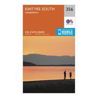
Ordnance Survey Explorer 256 Kintyre South Campeltown Map With Digital Version, Orange: The essential map for outdoor activities in Kintyre South Campeltown. The OS Explorer Map is the Ordnance Survey\'s most detailed folding map and is recommended for anyone enjoying outdoor activities including walking, horse riding and off-road cycling. This map now comes with a digital version which you can download to your smartphone or tablet. Providing complete GB coverage, the OS Explorer map series details information essential in the great outdoors, including youth hostels, pubs and...

Explorer 256 Kintyre South Campeltown Map With Digital Version: The essential map for outdoor activities in Kintyre South Campeltown. The OS Explorer Map is the Ordnance Surveyâs most detailed folding map and is recommended for anyone enjoying outdoor activities including walking, horse riding and off-road cycling. This map now comes with a digital version which you can download to your smartphone or tablet.

Llangollen & Berwyn - Os Explorer Active Map Sheet Number 255: Purchase the Llangollen & Berwyn folded map: single-sided (boarded cover) from the OS Explorer Map range

Llangollen & Berwyn - Os Explorer Map Sheet Number 255: Purchase the Llangollen & Berwyn folded map: single-sided (boarded cover) from the OS Explorer Map range

Ordnance Survey Explorer 255 Llangollen & Berwyn Map With Digital Version, Orange: The essential map for outdoor activities in Llangollen and Berwyn. The OS Explorer Map is the Ordnance Survey\'s most detailed folding map and is recommended for anyone enjoying outdoor activities including walking, horse riding and off-road cycling. This map now comes with a digital version which you can download to your smartphone or tablet. Providing complete GB coverage, the OS Explorer map series details information essential in the great outdoors, including youth hostels, pubs and visitor...

Explorer 255 Llangollen & Berwyn Map With Digital Version: The essential map for outdoor activities in Llangollen and Berwyn. The OS Explorer Map is the Ordnance Surveyâs most detailed folding map and is recommended for anyone enjoying outdoor activities including walking, horse riding and off-road cycling. This map now comes with a digital version which you can download to your smartphone or tablet.