Choose Which Site You Want To See



Explorer Ol 22 New Forest Map: Map sheet number OL 22 in the OS Explorer map series is the perfect map for holiday makers and day trippers to use when visiting the New Forest. The national park is famous for its excellent walks and rides and is home to New Forest ponies and heath land scenery.
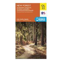
Ordnance Survey Explorer Ol 22 New Forest Map, Orange: Map sheet number OL 22 in the OS Explorer map series is the perfect map for holiday makers and day trippers to use when visiting the New Forest. The national park is famous for its excellent walks and rides and is home to New Forest ponies and heath land scenery. Colour Swatch:OrangeBrand:ORDNANCE SURVEYColour:Orange

Explorer Active Ol 22 New Forest Map: The essential map for outdoor activities in all weathers in New Forest. The OS Explorer Active Map is the Ordnance Surveyâs most detailed folding map and is recommended for anyone enjoying outdoor activities including walking, horse riding and off-road cycling. This map now comes with a digital version which you can download to your smartphone or tablet.
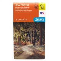
Ordnance Survey Explorer Active Ol 22 New Forest Map, Orange: The essential map for outdoor activities in all weathers in New Forest. The OS Explorer Active Map is the Ordnance Survey\'s most detailed folding map and is recommended for anyone enjoying outdoor activities including walking, horse riding and off-road cycling. This map now comes with a digital version which you can download to your smartphone or tablet. Colour Swatch:OrangeBrand:ORDNANCE SURVEYColour:Orange

New Forest - Os Explorer Active Map Sheet Number Ol22: Buy New Forest OS Explorer Map from the official Ordnance Survey Map Shop & get free delivery too.

New Forest - Os Explorer Map Sheet Number Ol22: Buy New Forest OS Explorer Map from the official Ordnance Survey Map Shop & get free delivery too.

Explorer Ol 41 Forest Of Bowland Map: An essential guide to the Forest of Bowland, the Explorer OL 41 from Ordnance Survey is a detailed map which covers the trails, paths and rivers which criss-cross this stunning and wild space. An Area of Outstanding Natural Beauty, the Forest of Bowland sits between Lancaster and the Yorkshire Dales National Park and is a spectacular place made up of gritstone fells, deep valleys and peat moorland.

Ordnance Survey Explorer Ol 41 Forest Of Bowland Map, Orange: An essential guide to the Forest of Bowland, the Explorer OL 41 from Ordnance Survey is a detailed map which covers the trails, paths and rivers which criss-cross this stunning and wild space. An Area of Outstanding Natural Beauty, the Forest of Bowland sits between Lancaster and the Yorkshire Dales National Park and is a spectacular place made up of gritstone fells, deep valleys and peat moorland. Colour Swatch:OrangeBrand:ORDNANCE SURVEYColour:Orange
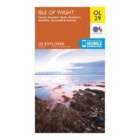
Ordnance Survey Explorer Ol 29 Isle Of Wight Map, Orange: Your essential guide to the Isle of Wight, the Explorer OL 29 from Ordnance Survey offers a detailed view of this special place and includes stunning places like Osborne House, Sandown and Ventnor. The many recreational paths which criss-cross this Area of Outstanding National Beauty allow you to navigate your way across the entirety of the Isle of Wight and the map even covers part of the New Forest National Park across the water. Colour Swatch:OrangeBrand:ORDNANCE...
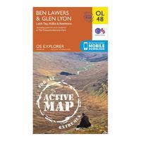
Active Explorer Ol 48 Ben Lawers & Glen Lyon Map: The Active Explorer OL 48 is a detailed weatherproof map which covers a wide area from Loch Lyon to Loch Tay. A replacement for the previous OS Explorer map 378 for this area, the OL 48 allows you to navigate your way around many of the Monros and Tay Forest Park, part of Loch Lomond & The Trossachs National Park.
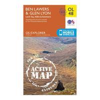
Ordnance Survey Active Explorer Ol 48 Ben Lawers & Glen Lyon Map, Orange: The Active Explorer OL 48 is a detailed weatherproof map which covers a wide area from Loch Lyon to Loch Tay. A replacement for the previous OS Explorer map 378 for this area, the OL 48 allows you to navigate your way around many of the Monros and Tay Forest Park, part of Loch Lomond & The Trossachs National Park. Colour Swatch:OrangeBrand:ORDNANCE SURVEYColour:Orange

Explorer Ol 45 The Cotswolds Map: The Explorer OL 45 from Ordnance Survey covers a wide area of the Cotswolds, a gorgeous and popular Area of Outstanding Natural Beauty made up of quaint villages and stunning architecture. Explore the many national trails and recreational paths which criss-cross this area or visit the Cotswold Hills, Wychwood Community Forest and the Cotswold Way.
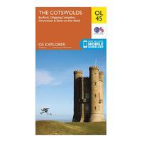
Ordnance Survey Explorer Ol 45 The Cotswolds Map, Orange: The Explorer OL 45 from Ordnance Survey covers a wide area of the Cotswolds, a gorgeous and popular Area of Outstanding Natural Beauty made up of quaint villages and stunning architecture. Explore the many national trails and recreational paths which criss-cross this area or visit the Cotswold Hills, Wychwood Community Forest and the Cotswold Way. Colour Swatch:OrangeBrand:ORDNANCE SURVEYColour:Orange

Explorer Ol 26 North York Moors Map (western Area): The Explorer OL 26 from Ordnance Survey covers the western area of the spectacular North York Moors National Park including the Cleveland Hills and Hambleton Hills. Visit the beautiful seaside retreat of Saltburn-by-the-Sea or move inland through the Community Tees Forest into the North York Moors National Park and navigate the many trails which work their way along Cleveland Hills and the Hambleton Hills.

Ordnance Survey Explorer Ol 26 North York Moors Map (western Area), Orange: The Explorer OL 26 from Ordnance Survey covers the western area of the spectacular North York Moors National Park including the Cleveland Hills and Hambleton Hills. Visit the beautiful seaside retreat of Saltburn-by-the-Sea or move inland through the Community Tees Forest into the North York Moors National Park and navigate the many trails which work their way along Cleveland Hills and the Hambleton Hills. Colour Swatch:OrangeBrand:ORDNANCE SURVEYColour:Orange

Memory Map Explorer New Forest And South Downs Cd Rom, Assorted: Featuring detailed OS Explorer 1:25, 000 scale mapping and virtual mapping, the Memory Map Explorer New Forest and South Downs CD ROM is an essential piece for walkers, hikers and mountain bikers. Create and print maps from your PC to create personalised routes and easily add waypoints and tracks to your GPS.Brand:MEMORY MAPColour:Assorted

Explorer New Forest Map: This Ordnance Survey Map of the New Forest is map sheet number OL22 and the perfect map for walks in and around the New Forest region

Two Hour New Forest Horse Riding Experience: Escape the stresses of everyday life with this thrilling and relaxing Two Hour New Forest Horse Riding Experience. The New Forest National Park was the hunting ground of Kings as far back as William the Conqueror and the best way to explore its plains and enclosures is still on horseback. Take a relaxing journey amongst some beautiful scenery in the English countryside. Whether you\'re a novice or an experienced rider, this horse riding experience can be enjoyed by everyone. The ride will take...

Riding Break For Two In The New Forest: This excellent riding break situated on the edge of the New Forest is the perfect way to spend a couple of days exploring beautiful woodland on the back of a trusty steed. Ideal for beginners and more experienced riders, arrive on the morning of the stay for either a 45 minute private riding lesson or a 90 minute ride through the scenic forest (either western saddle or traditional saddle). In the afternoon, check in to Bashley House and stay in a double room with en suite facilities. Enjoy a...

Garmin Gb Discoverer Mapping 1:50k - The New Forest And South Downs: Explore The New Forest and South Downs with your GPS device in the renowned detail of OS Landranger mapping with this microSDÃ card Garmin GB Discoverer 1:50K. Also includes NAVTEQ road data and points of interest, and you\'ll get turn-by-turn directions