Choose Which Site You Want To See



Map Postcode Area Uk Planbipa: FeaturesLaminated Postcode Map. Full colour map clearly showing the country broken down by Postcode area (in red), with county boundaries (in Green). Greater London postcodes illustrated in an inset. Scale 12. 5miles : 1 inch. Size: 120 x 83cm.

Map Marketing Uk Postcode Areas Laminated Map Bipa: Map Marketing UK Postcode Areas Laminated Map BIPA

Map Marketing Postcode Areas Map (unframed) Scale 12.5 Miles To 1 Inch: Map Marketing Postcode Areas Map (Unframed) Scale 12.5 Miles to 1 inch

Map Marketing Framed Uk Postcode Areas Map Fram-bipa: LAMINATED MAPS Permanently bonded between two sheets of tough, flexible, crystal clear plastic making them virtually indestructible. It also gives the map surface a dry or white finish allowing you to update information at a stroke. Detailed 4-colour

Map Marketing Postcode Areas Map Unframed Scale 12.5 Miles To 1 Inch: LAMINATED MAPS Permanently bonded between two sheets of tough, flexible, crystal clear plastic making them virtually indestructible. It also gives the map surface a dry or white finish allowing you to update information at a stroke. Detailed 4-colour

Map Marketing British Isles Motoring Laminated Map Bim: With every motorway and A-road included, plus shaded relief colouring for terrain, its a handy addition for home or office. Inset boxes cover roads within London, a smaller-scale map of Ireland, and postcode areas. Plus, theres two useful mileage

Personalised Postcode Map 10x8 Oak Effect Frame - Present Day: Personalise this Present Day Edition map with any postcode of your choice. The map will then display the local area surrounding your chosen postcode. Your map is then framed in a stunning 10x8 Oak Effect Frame. Scale is 1:50, 000Maps

Map A-z Postcode Of Greater London: FeaturesMap Marketing A-Z Postcode Map of Greater London. Laminated roll-up map detailing all postal zones in the Greater London area - roads are less prominent to ensure that the postcode information takes precedence.

Personalised Postcode Map 10x8 Oak Effect Frame - Old Series: Personalise this 1805 - 1874 Old Series map with any postcode of your choice. The picture will then display the local area surrounding your chosen postcode. Your map is then framed in a stunning 10x8 Oak Effect Frame. Scale is 1:50, 000

Personalised Map Mug: Porcelain mug uses your choice of postcode to reproduce the local area from the 194548 New Popular edition map in 1:50, 000 scale. Maps are not available for Northern Ireland The Channel Islands or the Isle of Man (any postcodes starting with BT GY JE or IM).Please note the following Scottish postcodes are not available on this mug:AB DD DG EH FK G HS IV JA KW KY ML PA PH TD ZE. Porcelain.3 ½" tall. Additional delivery charge £3.00.Please allow up to 2 weeks for delivery.

Map Marketing Postal Districts Of London Map Unframed - Scale 1 Mile1: Map Marketing A-Z Postcode Map of Greater London. Laminated roll-up map detailing all postal zones in the Greater London area - roads are less prominent to ensure that the postcode information takes precedence. Fully coloured map showing postal

Personalised Map 400-piece Jigsaws: A unique made-to-order 400-piece map jigsaw centred on a place of choice. Simply enter a postcode in the box provided above. The result is an intriguing puzzle that will certainly draw on your local knowledge and to help you get started the centrepiece is shaped like a house. For that added personal touch there is an area on the box lid for you to write a description title or message. The 32 x 47cm jigsaw shows in Ordnance Survey Map form an area 9 miles North to South and 14.5 miles East to...
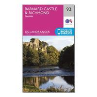
Ordnance Survey Landranger 92 Barnard Castle And Surrounding Area Map With Digital Version, Orange: The OS Landranger Map is the ideal map for planning the perfect day out. This best known national map series provides all the information you need to really get to know an area, whether you are a visitor or a local resident. This map comes with a digital version which you can download to your smartphone or tablet. Go to OS.uk/redeem for more details (terms and conditions apply).Scratch off the panel on the inside cover of the map to reveal a code, you are then just three easy steps away from...
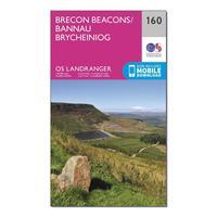
Ordnance Survey Landranger 160 Brecon Beacons Map With Digital Version, Orange: The OS Landranger Map is the ideal map for planning the perfect day out. This best known national map series provides all the information you need to really get to know an area, whether you are a visitor or a local resident. This map comes with a digital version which you can download to your smartphone or tablet. Go to OS.uk/redeem for more details (terms and conditions apply).Scratch off the panel on the inside cover of the map to reveal a code, you are then just three easy steps away from...
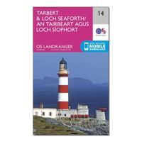
Ordnance Survey Landranger 14 Tarbert & Loch Seaforth Map With Digital Version, Orange: The OS Landranger Map is the ideal map for planning the perfect day out. This best known national map series provides all the information you need to really get to know an area, whether you are a visitor or a local resident. This map comes with a digital version which you can download to your smartphone or tablet. Go to OS.uk/redeem for more details (terms and conditions apply).Scratch off the panel on the inside cover of the map to reveal a code, you are then just three easy steps away from...
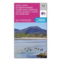
Ordnance Survey Landranger 13 West Lewis & North Harris Map With Digital Version, Orange: The OS Landranger Map is the ideal map for planning the perfect day out. This best known national map series provides all the information you need to really get to know an area, whether you are a visitor or a local resident. This map comes with a digital version which you can download to your smartphone or tablet. Go to OS.uk/redeem for more details (terms and conditions apply).Scratch off the panel on the inside cover of the map to reveal a code, you are then just three easy steps away from...
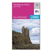
Ordnance Survey Landranger 12 Thurso & Wick, John O\'groats Map With Digital Version, Orange: The OS Landranger Map is the ideal map for planning the perfect day out. This best known national map series provides all the information you need to really get to know an area, whether you are a visitor or a local resident. This map comes with a digital version which you can download to your smartphone or tablet. Go to OS.uk/redeem for more details (terms and conditions apply).Scratch off the panel on the inside cover of the map to reveal a code, you are then just three easy steps away from...
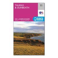
Ordnance Survey Landranger 11 Thurso & Dunbeath Map With Digital Version, Orange: The OS Landranger Map is the ideal map for planning the perfect day out. This best known national map series provides all the information you need to really get to know an area, whether you are a visitor or a local resident. This map comes with a digital version which you can download to your smartphone or tablet. Go to OS.uk/redeem for more details (terms and conditions apply).Scratch off the panel on the inside cover of the map to reveal a code, you are then just three easy steps away from...
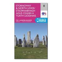
Ordnance Survey Landranger 8 Stornaway & North Lewis Map With Digital Version, Orange: The OS Landranger Map is the ideal map for planning the perfect day out. This best known national map series provides all the information you need to really get to know an area, whether you are a visitor or a local resident. This map comes with a digital version which you can download to your smartphone or tablet. Go to OS.uk/redeem for more details (terms and conditions apply).Scratch off the panel on the inside cover of the map to reveal a code, you are then just three easy steps away from...
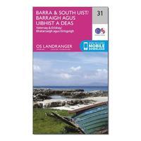
Ordnance Survey Landranger 31 Barra & South Uist, Vatersay & Eriskay Map With Digital Version, Orange: The OS Landranger Map is the ideal map for planning the perfect day out. This best known national map series provides all the information you need to really get to know an area, whether you are a visitor or a local resident. This map comes with a digital version which you can download to your smartphone or tablet. Go to OS.uk/redeem for more details (terms and conditions apply).Scratch off the panel on the inside cover of the map to reveal a code, you are then just three easy steps away from...